During our most recently trip to Italy, in between Florence and Cinque Terre, we spent a few days in the mountains. We did two amazing hikes (in one day, I’d recommend spacing them out a bit better!), the details of which you can find below.
During our most recently trip to Italy, in between Florence and Cinque Terre, we spent a few days in the mountains. We did two amazing hikes (in one day, I’d recommend spacing them out a bit better!), the details of which you can find below.
We had the best time in Tuscany! This was the part of the trip I was least excited for and it wound up being my favourite part.
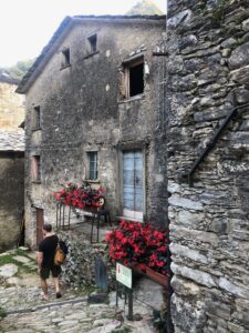
We stayed in Mulina, which was quite well located for the two hikes we ended up doing. The flat was really quite and spotlessly clean, with a nice area for eating outside as well. We’d definitely return here in the future.
(Just a note, that as this was during the COVID times, all of these places had outdoor and socially distanced seating.)
We ate some of the best food of the trip in this area. On our way up we stopped at Osteria La Risvolta for lunch and ordered off the server’s recommendation. It was insanely good. Every day we planned to go back, but we kept finding new places to try and sadly never returned.
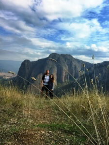
The second day we had a picnic lunch on top of Monte Forato – bread, meats, cheeses and wine of course. It was lovely 🙂
The first night we had dinner close by at Trattoria Luciana Mulina. This was out of convenience, though our host did recommend it, and though it’s laid back looking, the food really surprised us. It was also totally delicious and a great local spot if you’re nearby.
After our epic day of hiking, we ate at Il Soggiorno. This place is kind of crazy to get to (you drive down a long windy road that isn’t totally convincing as a road), but the staff were so lovely and the food was so good and the portions were giant.
The one place we wanted to try but couldn’t was Osteria Candalla. If you’re going to be in the area (hiking or swimming most likely!), this place is popular enough that it’s necessary to book ahead.
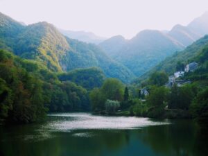
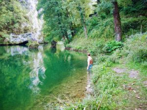 We did the best stuff! The day we arrived it was hot and we wanted to find somewhere to cool down, so we drove up to Isola Santa lake, which is nestled in this adorable village, and swam around. The water was so refreshing and you swim right over ruins of Medieval buildings.
The next day we did two hikes because we couldn’t choose between them. If you plan to do this, I’d suggest breaking them up though I am not the fittest person in the world and survived doing both in one day.
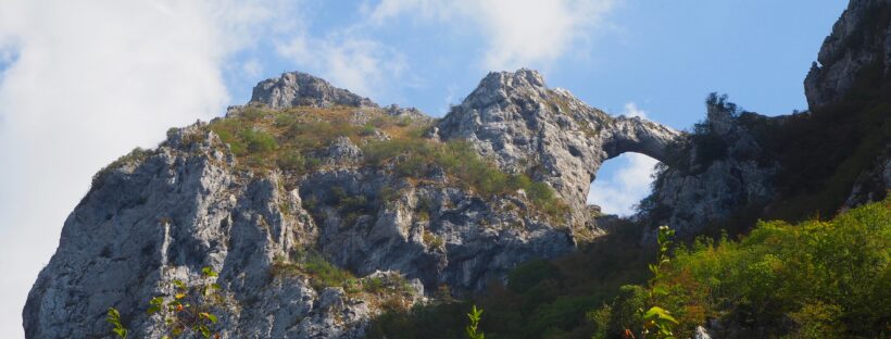
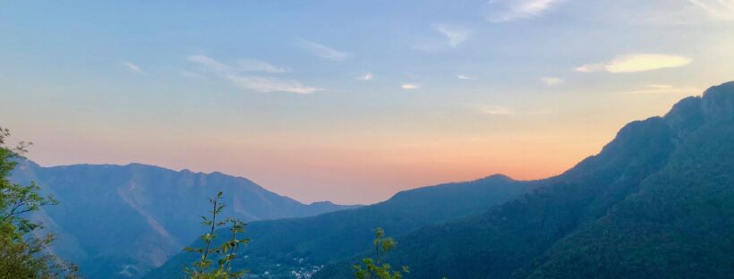
We spent the morning hiking Monte Forato, mainly because we saw the peak on the way to Isola Santa the night before and decided it would be fun to climb – and it was!

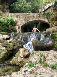
Then we spent the afternoon doing the magical Candalla waterfalls hike.
 You can read the details here!
We only had two days in Tuscany, if we go back we’ll stay longer and explore more. I thought we’d lack for things to do but there is so much on in this area. I can’t wait to return!
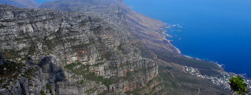
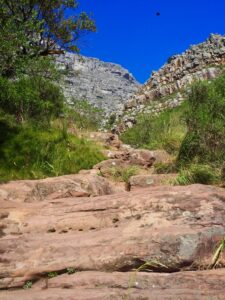
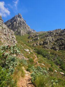
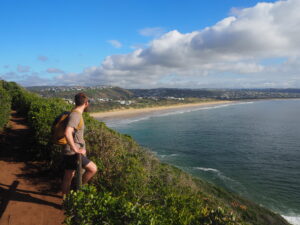
When we first decided to go to South Africa, but before we had started planning, only one thing was certain – we’d be hiking Table Mountain. As we both love hiking, there was no way we could get to such an iconic mountain and take a cable car to the top.
Then we actually got there and man was it tall. I’m not going to lie, the first 10 minutes or so, I complained pretty much non-stop. I was hot, I was tired, I was sunburnt — bless Gareth for not leaving me behind and only mocking me a little.
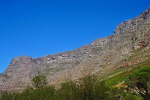
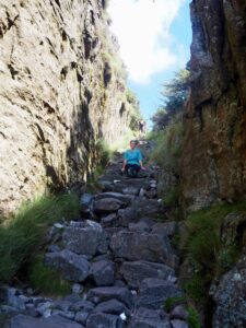
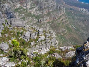
Then we actually got to the start of the Platteklip Gorge and I was too out of breath to keep complaining! It is steps the whole way up, under the baking sun. About halfway through I was using my arms as well as my legs to get me over each step. It wasn’t easy! (Unless you’re Gareth and then everything is easy!)
We took a lot of beaks, every time we reached shade. Our sun burns from our hike in along the Garden Route and the fact that we were still on Malarone meant that halfway up my arms started to blister, and by the time we reached the top I was seriously concerned about the state of my skin. (I applied factor 50 about every five minutes, it was no match for the sun. Eventually I gave in and wore Gareth’s sweaty shirt.)
Getting to the top was INCREDIBLE though. The absolutely gorgeous view made each difficult step worth it. It took us about two hours (I stopped a lot), and we hung out at the top for about the same amount of time. There’s a cafe/grocery store up there, as well as a little shop with souvenirs. There’s even a mailbox, where I sent myself and my momma a letter!
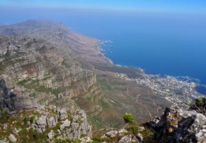
We took in the views before finding shade, some beverages, and whipping out our trusty cards. It was such a lovely afternoon, marred only by the cable car down, which was too high for my liking. If you’re in relatively good shape, definitely consider climbing to the top. It’s hard but worth it and far more rewarding than standing in a line and letting an elevator do the work for you!
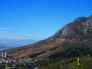
Lion’s Head
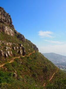
For keen hikers, there are many more options than just the Platteklip Gorge.
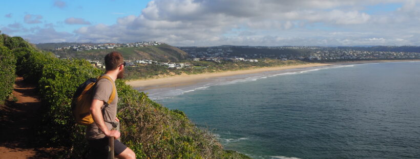
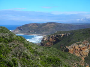
Though our hike in Robberg Nature Reserve was perfect, there are loads of other amazing hikes along the Garden Route as well. Find a breakdown of the ones I was most interested in below.
Half-collared Kingfisher Trail (7.2km, +/- 3hrs)
This one follows Touw River into the forest, where you take a pontoon across to the eastern bank of the river, where you walk down a 2km boardwalk that leads to a waterfall. We were really sad to miss this one — if you go let me know how it was!
Brown-hooded Kingfisher Trail (5km, 2-3 hrs)
This trail is opposite the eastern bank of Island Lake. You follow along the Duiwe River to a waterfall where there is a natural pool where you can take a dip!
Harkerville Forest – Perdekop Trail (9.5km, circular, 3-4 hrs)
This hike is another one we were really sad to miss! You pass by a waterfall with another natural swimming pool beneath it, and it’s said to be relatively easy.
Harkerville Forest – Kranshoek Coastal Day Trail (9km, 4-5 hrs)
This hike starts at the top of a tall waterfall and the trail winds down to the bottom gorge, and then goes back up, ending at the Kranshoek view point. This is a moderate hike with over 200m ascent and descent.
Diepwalle Forest – Elephant Trails (all circular, 3-4 hours)
There are three routes here of varying difficulty, all along old woodcutter paths and by old yellowwood trees. The Black Trail is the easiest (9km) and passes through the King Edward VII picnic site. The White Trail is moderate (8km) and has a rock pool. The Red Trail (7km) is the most difficult and crosses a small stream about midway through that is ideal for a rest stop.
Storms River Mouth Trail (1km, 1 hr)
This easy trail takes you to the suspension bridges, one of Storms River’s claims to fame. They are stunning and you won’t want to miss checking these out!
Lourie Trail (1km, 1hr)
This is an easy trail that will allow you to see the indigenous forest without too much time or effort. After a quick but steep climb up, you’ll emerge at the Agulhas lookout, and then through some gorgeous fynbos and the coastal forest.
Waterfall Trail (6km, 3-4 hours)
For half this trail you’ll be following along the incredibly famous and beautiful Otter Trail (if you have time/interest in multi-day hikes, check out the Otter Trail!).It follows the gorgeous coastline and ends at a stunning (in the rainy season) waterfall.
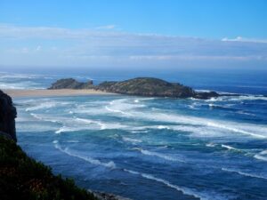
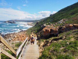
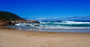
While we were in South Africa, there were so many hikes along the Garden Route we had the option of doing, it was overwhelming in the best way! We had planned on doing three: The Waterfall Trail in Tsitsikamma National Park, the Robberg Nature Reserve, and the Wilderness Heritage Trail. We ended up only doing Robberg and if you only have time for one, this is the one. It was stunning! I also have a post with more information on other options, if you’re interested.
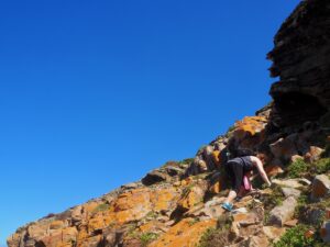
Before setting out I was quite nervous, as I had read it was fairly difficult and maybe not for beginners. It was not technically difficult. There were two steeper bits where a rope is provided for balance, and one point where you’re climbing up a bit vertically, but if I can do it (me, who is terrified of heights) anyone with a reasonable level of fitness certainly can.
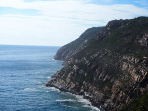
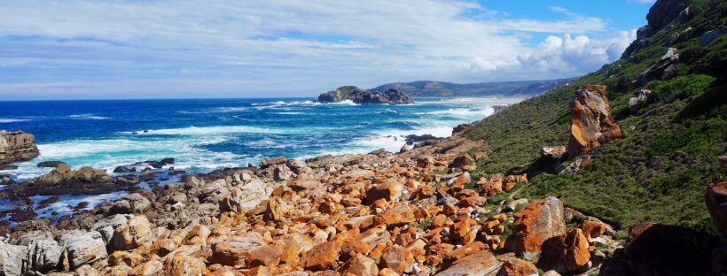
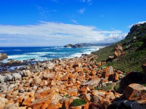
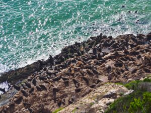
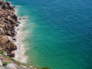
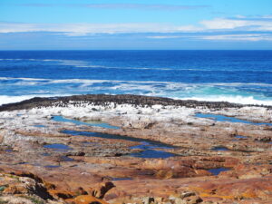
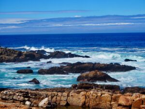
There trail has three options. The third is the longest, taking you completely around the point, which is around 9.2 km. The first half is much easier than the first, as it’s mostly a well-defined grass/dirt trail. The views are stunning and there are so many families of seals along the way. They smelled terrible but it was incredible to see them just playing in the surf.
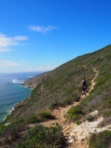
The second half was for sure more difficult. There’s a long stretch where you’re moving up and down through big rocks, and we had to slow down quite a bit. That said there were a few locals who were running, so I guess how fast you go is just down to confidence!
The other two route options are shorter and easier – option two brings you around the The Witsand sand dune and gives the option to circle The Island (only accessible during low tide) and is around 5.5 km. Option one brings you to The Gap and is only 2.1 km, but still quite beautiful.
It was also one of the most beautiful places I’ve ever been. The colors of the rocks, the sea, and the land were like a painting. Or like I was living inside an Instagram filter!
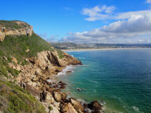
About 75% of the way through, we came to a little beach where we had one of the most refreshing swims ever! There weren’t many people around and it felt like we had discovered a hidden treasure. It’s also where the sunburn to end all sunburns happened. Top tip: if you are on Malarone, never expose any skin to sun, regardless of the amount of SPF 50 you slather on.
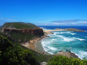
If you’re on the Garden Route and looking for a hike, I highly, highly recommend this one. While there are tons and if we ever go back there are so many more I want to explore, I really do think this was the pinnacle. If you’re up for an adventure, we passed a little cottage about midway through with an INCREDIBLE view that can be rented for around 55 GBP a night. It’s about a two hour walk to and from, and there’s no electricity, but would be a fairly epic night! You can find more info about that here. (Book way in advance!)
So we left off with us making the decision to go home, and we were waiting for the bus in San Millan. And waiting. And, guess what? No bus appeared. Either we were in the wrong spot, or the online bus schedule was wrong, but it was clear there was no option but to walk to Anguiano, and catch the bus from there as originally planned. I’m not gonna lie, at this point I was pretty nervous. I stretched and thought about crying and finally decided to pretend I was on The Challenge and just power through.
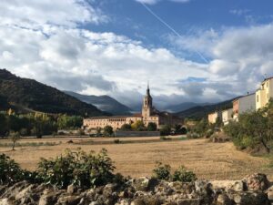
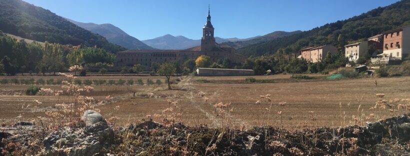
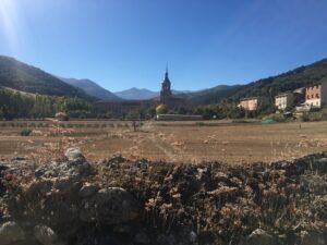
On the bright side the bus stop was right by the monastery, which was so pretty in the morning.
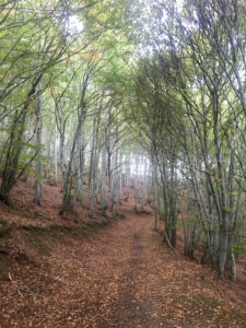
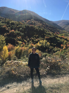
We had a huge day ahead of us, so we prepared with a huge breakfast. This slightly improved my mood, as did the chocolate Gareth started forcing me to eat at random intervals. And I am SO glad we did the second day. Yes, by the end I was limping along, positive I had irreparably damaged my knee, but the second day was so gorgeous. We walked through the forest for a few hours, and didn’t see a single other person. We walked on a mountain rim, and saw an amazing mountain pass, with a path through it. Probably we’ll need to come back one day to climb it, because it was incredible.
After about four hours of walking we passed a town that had a bar that was miraculously open, and we stopped and had a snack and a glass of wine. Then we walked about five more minutes and saw a trail marker. I ran up to it, sure we had another hour or two at most, because I was naive, and the wine had improved my view of the world. I found that we were halfway. Halfway.
There’s no picture of this marker because honestly, the discovery stung a bit. We’d been taking it slow because of my knee and suddenly I was worried we were going to miss our bus back to Logroño. But the next hour or so was all on flat ground, and we passed through a town and then walked on a (really pretty) street for quite a while. It was a nice break, and still really gorgeous.
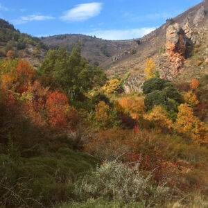
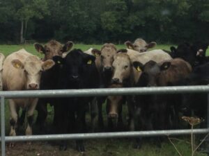
Eventually Anguiano was in sight, but not before the path led us up a long and winding mountain. It was really incredible–we could see the trees with all their colors everywhere, the village across the river, and there were cows EVERYWHERE. Up until this point we had encountered many a cow, but always with enough room to just casually (or frantically, if you are me and not Gareth) walk by them. But now we were on a MUCH narrower path and there were about five cows just chilling along the way. We tried to herd them a bit before G climbed up a trail behind them and dropped a rock down. (To be clear NOT on them, just so the noise disturbed them and they moseyed away.) Then we were on the real and actual final stretch. We had to walk back down the mountain which was the final straw for my knee. Before the descent, however, there was a marker saying only 2 kilometers left, which gave me the motivation I needed to get it done. THAT SAID, that marker is a huge lie and it was much, much more than 2K. Just FYI. I commandeered a stick as a crutch and hobbled along like a crippled 90 year old woman. Also I slipped and fell in mud/possibly poo hahaha. So imagine how amazing this trek was that I was STILL amazed by the beauty and so happy to be there.
At the end of the final trail there was a gate to the bridge that would let us cross the river into town. We were done, except for the last cow in our way. Gareth went to herd it and discovered that no, it was not a cow. IT WAS A BULL. He attempted to tell me this in a calm and reassuring manner, which my brain interpreted as him calmly telling me to GTFO of there. So in about .5 seconds I had slid between the fence that was keeping us all in and was dangling on the mountain ledge. G walked over, asked WHAT I was doing and if I would please come out so we could carry on walking. Oops. In reality this guy seemed way less interested in us than any of the cows were. That said, Gareth and I have made some cow enemies over the years…
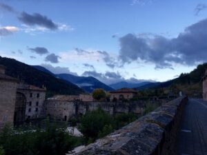
Anyway, we went through the gate, into safety, across the bridge, and INTO ANGUIANO!
The bus stop back to Logroño is right by the bridge and there was a bar about a minute farther down the road. Again it wasn’t a time they were serving any food, but it was the only place open. So they offered to make us some bocadillos, and we played cards and drank wine for a few hours until our bus. It was pretty excellent.
I cannot recommend this hike enough. It was INCREDIBLY gorgeous, had a seriously diverse landscape–sometimes we were in mountains, sometimes in the forest, by a river, or passing through a small village. Other than our start, mid, and end points, we only saw four other people the entire time, and they were all working on the land. We had the entire trail to ourselves, and that was as amazing as it sounds.
Pertinent Information:
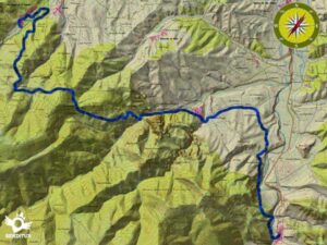
It was SUPER well marked, though we did get lost once and it was pretty much the worst. We had just spent about 45 minutes going down a long, winding road to the bottom of a mountain. And then the trail seemed to be taking us straight back up, just on a direct/steeper trail. I was so sure it was a shortcut to get down to where we were from the top, but G ran ahead on the road we were on and there wasn’t another marker anywhere nearby us. So we took the incredibly steep trail, which led us… back where we started. It was pretty disheartening. We debated going back down the long, easy way, but I couldn’t imagine sinking another 45 minutes into it, and we were back down the steep path in about 20 minutes. And discovered the trail continued straight ahead, behind the road we had been on. We didn’t think to look down the edge of the road, but that’s where the next marker was. BUT other than that, we didn’t miss a beat and I can’t get over these trails Spain just has built in everywhere, no maps needed!
The buses to/from Logroño and Anguiano were super easy. We bought the tickets on each bus, and slept during the rides. The way there was about an hour and fifteen minutes and the way back was 45. I have no clue what the bus situation in San Millan is, and if you figure it out please let me know!
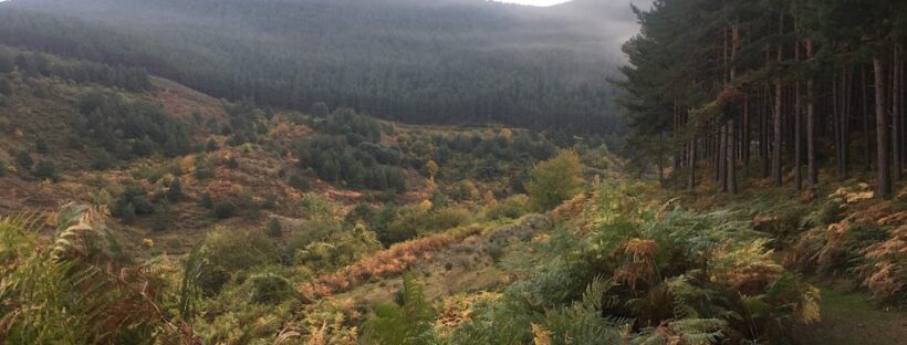
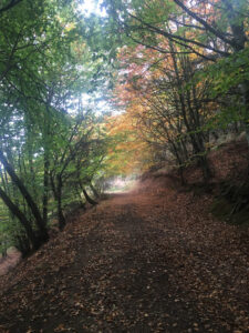
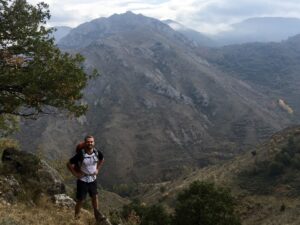
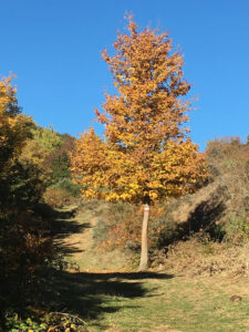
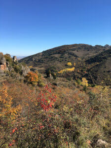
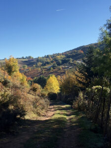
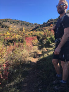
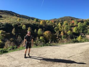
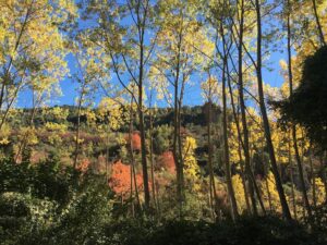
A few weeks ago Gareth came back to Logroño so we could work on our new goal to do all the best hike in northern Spain, this time by doing a few days of the GR-93. I heard about this route before coming to Spain and it was at the top of my list because it was supposed to offer amazing views with tons of fall foliage–basically all this New England girl could ever want. Spoiler alert, it delivered.
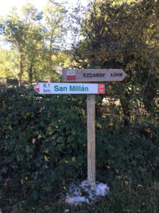
The portion we would be doing would start from Ezcaray, with a night in San Millan de Cogolla, and the bus back to Logroño from Anguiano.
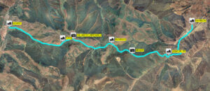
day one
day two
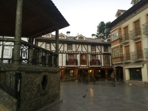
We left Logroño Friday morning on the only early bus (6:45 am) and we arrived in Ezcaray at 7:30 am. It was dark. It was FREEZING. Apparently it’s much colder in Ezcaray than the surrounding areas, which on the plus side means come winter there’s skiing, and on the terrible side means we were dropped off on the outskirts of a freezing, empty, dark town. Guys it was so cold. We walked the most intuitive way, and ended up in the town center. No food places were open yet, but there was a tiny shop open that served coffee and tea. We went inside and pooled all the clothes we had to try to warm up (read, I stole every article of clothing Gareth wasn’t wearing, and one he was). We had tea, watched Spanish news tear into Trump, and then when the sun came out and a few other shops opened, left to find breakfast. Also in the light of day this was one of the prettiest little villages I’ve seen so far.
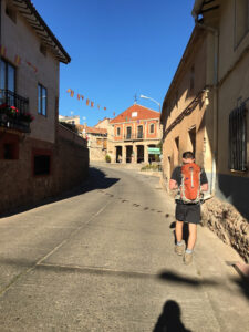
The great thing about this hike, and all Spanish hikes I’ve experienced thus far, is that they are all very well marked with paint. This route was red and white, and it became a game (though not a fun one because my competition was not nearly on my level), to see the markers first.
can you spot the marker?
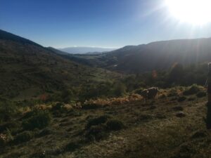
The first day was amazing. We basically hiked up a mountain, down a mountain, walked through the town, and back up the next mountain. Did anyone else, as a kid, ever see mountains or hills in the distance and really want to climb them just to see what was on the other side? That’s what this was like. And these villages… I honestly didn’t know people lived in villages so small. I’m still not sure they DO because we never actually saw any people in the smallest ones. To be honest, we didn’t see many people in the larger ones either. It was strange. We didn’t prepare well, and only had a little bit of food for the journey, so every time we did see a person we asked if there was anywhere to buy any food and the answer was always no. Even in San Millan de Cogolla, the much more populated village where we spent the night, the nearest supermarket was 5 kilometers from town. What!
Right at the end of the first day, my knee started hurting. I injured in a million years ago doing gymnastics, and we have worked out a deal where basically if I don’t use it, it won’t bother me. So I don’t do lunges or high impact activities, and it pretends it’s a fully functioning knee. But descending five different mountains in about six hours was pretty much its breaking point, and I hobbled the rest of the way into San Millan.
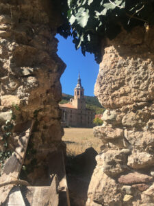
San Millan, it has to be said, is COMPLETELY gorgeous. The walk in is along a river and a really cool stone wall/orchard. The village is fairly big, and has a few different monasteries (one of which houses the first record of written Spanish), and we saw more than five people just out and about, which is a real crowd in smaller Spanish villages. You might say San Millan was hoppin’. (But you shouldn’t because it was still only about five people.)
In my research I couldn’t find anywhere in San Millan to stay, but I found a few options on airbnb in Berceo, which was only 1.5 kilometers away. The only downside is you have to walk down a fairly busy street, which was fine during the day, but after seeing the way people were whipping by at night, and how dark it was, we played it safe and had dinner at the one restaurant in Berceo instead of heading back to San Millan.
Berceo kind of freaked me out at first. There was no one around. Small Spanish villages often feel like ghost towns, or like you accidentally just wandered into Roanoke. Add to that the fact that there was nowhere to buy any sort of groceries or pharmacy related items, my knee was killing me, we were trapped and couldn’t safely get to San Millan, I started feeling like we were in a horror movie. We found the one dinner place, and were two of about four patrons there when we arrived at 8:00. They told us the kitchen wasn’t open yet, because this is Spain and 8:00 pm is still way too early for dinner, but they were super nice and gave us snacks while we waited.
So we played cards–side note, the most common deck of cards here only has 40 cards in a pack! There aren’t any face cards, and the whole thing is pretty confusing. We invented a bastardized version of golf, drank some more wine (which helped me switch from thinking we were in a horror movie to a tiny romantic village), and by the time the first of our three courses arrived, I was feeling much better.
Better mentally that is, physically my knee was at about a code red/black. Whichever is worse. We went to sleep knowing that we might not be able to continue the next day, and planned to walk to the bus stop in San Millan to assess how I felt and potentially go back to Logroño. There were only two buses from San Millan, one in the morning and one at night, and the smaller villages we were passing through didn’t even have people, let alone bus service. So we woke up early, walked to the bus stop assessed. I decided I was being insane and if I could barely walk for five minutes, a seven hour hike up and down a bunch of mountains was a terrible idea. The bus however, had other plans!
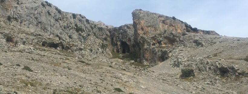
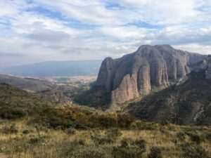
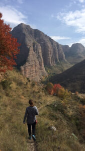
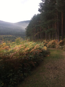
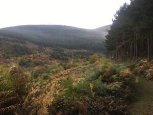
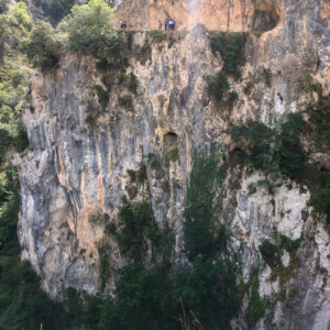
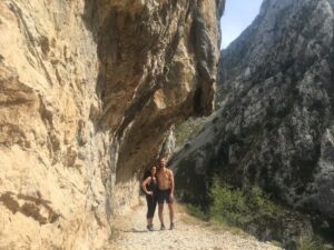
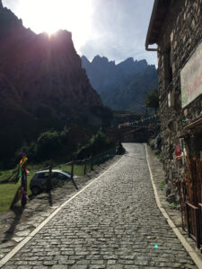
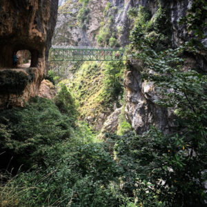
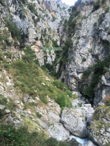
The highlight of our Asturian road trip was the Ruta del Cares. We spent the day before seeing the Covadonga Lakes and Mirador del Fitu. We spent the night in Las Arenas – though the trail starts in Poncebos, I had a hard time finding accommodation there, so we stayed the next town over. We woke up at like 7am (before the entirety of Las Arenas/the sun), and drove the 15 minutes to the start of the hike. Again there was another free parking lot at the start of the trail. We had coffee/tea at a restaurant/hotel that was right there, and then we were on our way!
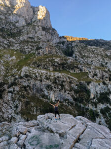
The hike was amazing. It was like being in another world, just up on the edge of a mountain. We started really early so we only passed a few other people on the way.
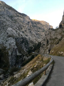
It is high. There’s really no getting around that, much as I hated it. But if you stay on the inside of the trail, you can’t really see the drop off, and it feels pretty okay. The biggest problem was on the way back, when we were on the outside and virtually none of the couples we passed would separate long enough to let us pass by without being forced to the very edge of the cliff. Tip: if you are on a narrow path with a million foot drop off, detach from your SO long enough to let the people on the outside comfortably pass. It’s basic human decency.
The trail is meant to be 3 hours each way, but we did it in 2.5 there and 2.75 back without trying too hard. The very beginning is the only real elevation, so it’s a pretty steep 20 minute climb. This was harder on the way down because it’s really easy to skid and the consequences of falling are pretty much life ending. So slower was good at that part, but after that bit the walk was flat and super easy.
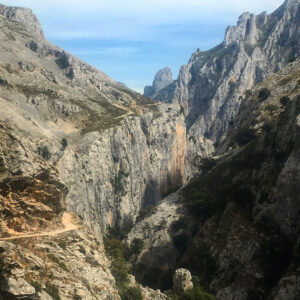
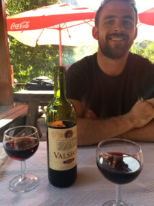
The route is from Asturias to Castilla y Leon, and ends at a tiny, tiny pueblo called Caín. It’s a few houses, I think four restaurants that cater to hikers, and a gift shop that looks pretty stuck in time. We got there before lunch, and had to wait for about an hour for any food to be ready. But then we got to have our second menu del dia of the trip, and man am I obsessed. You basically get bread, two large/medium sized plates, water/coffee/tea, dessert, and a BOTTLE OF WINE for like 10 euros. They have this in Logroño but it’s like twice as expensive so not as cost effective as pincho hopping.
After a big meal and a half a bottle of wine each, we headed back. This time it was much busier because the after lunch crowd all left around the same time, but even though it took longer it felt much faster. Maybe because of all the wine?
Notes for other people with a very rational fear of heights… there are only two points that really freaked me out–the two bridges. One is where the path has kind of given way. It’s really short and you can be over it in about 5 seconds, but there’s a point where the bottom is a grate you can look through the get a clear idea of how very heigh you are. I would suggest not looking. The second bridge was way worse because you cross from one side to the other and that is long and really high and I didn’t enjoy it one bit. Otherwise, if you stick to the inside you can virtually never see the drop and can pretend it doesn’t exist.
We finished the hike, and started the long drive back to Logroño. Did you know that road tolls in Spain are like 20 euros every time? Because we did not and that is something worth including in the old budget. Also gas is ridiculously expensive in Europe, but I think that’s more commonly known. We pulled over into some weird industrial space and I had my first lesson (of this decade) on how to drive stick. It was pretty easy but there weren’t any other cars around and I think that made a prettttty big difference. I can tell you this much, I didn’t like it. I don’t why you’d choose to make driving more complicated, but that’s just me (being logical).
We arrived home and collapsed in a heap of exhaustion. It was a lot of driving. Again, sorry G. But also totally worth it. (So, also you’re welcome.)